An 18 slide PowerPoint presentation to use when teaching students about the main features of the world map.
This teaching resource is a Geography PowerPoint presentation that teaches students the main features of the world map.
Mapping features include:
- Lines of latitude
- Equator
- Hemispheres
- Tropics
- Arctic Circle
- Antarctic Circle
- Lines of longitude
- Prime Meridian
- International Date Line
- Continental Regions
- Oceans
- Countries
- States
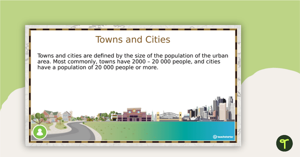
- Towns and Cities
Use this resource in conjunction with the World Mapping Booklet – Worksheet.
Notes: Mapping features and terminology can differ depending on the location or point of view. Ensure you read over the included features to see where you may need to further explain variables to your class.


0 Comments
Write a review to help other teachers and parents like yourself. If you'd like to request a change to this resource, or report an error, select the corresponding tab above.