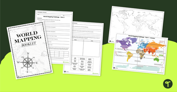
Develop mapping skills by plotting key features and locations onto a map of the world.
Mapping Activities for Upper Years Students
Take your students on a journey around the world with this world mapping booket!
Students will use their mapping skills to locate and plot various key locations on a map of the world, such as:
- the Equator
- the Tropic of Cancer
- the Tropic of Capricorn
- the Arctic Circle
- the Antarctic Circle
- the Prime Meridian
- the International Date Line
- the seven continents
- and more!
The workbook also contains a list of questions to further develop your students’ knowledge of world geography.
Multiple Applications for Mapping Activity
There are many possibilities when it comes to using this resource in your classroom! Use this booklet as a:
- collaborative group activity
- independent research project
- homework assignment
- summative assessment.
Download, Print, Teach!
Use the Download button to access the easy-print PDF version of this resource.
This activity has been designed in conjunction with the World Mapping Features – Teaching Presentation.


0 Comments
Write a review to help other teachers and parents like yourself. If you'd like to request a change to this resource, or report an error, select the corresponding tab above.