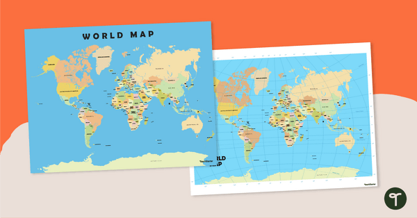
Teach your students about the continents and countries of the world with this detailed map.
Explore the World Without Leaving the Classroom!
Are you venturing on an adventure into World Geography with your students? Well, they will need to become familiar with the world’s continents and countries!
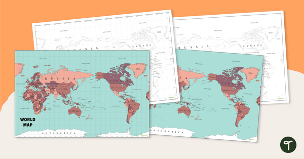
This world map enables your students to become more familiar with the seven continents and approximately 195 countries that comprise our great planet. The map comes in two download options to best suit your teaching and learning needs! The options include:
- Color map with lines of latitude and longitude
- Color map without lines of latitude and longitude
Multiple Uses for These Maps of the World
These maps of the world with labeled countries make a great asset to your Social Studies lessons and can be used in a multitude of ways in your classroom. Here are some suggestions:
Explore the location of the world’s countries as a whole-class activity
This map of the world is the kind of resource that any teacher of world geography needs to access on a frequent basis! Project the map onto your interactive whiteboard for a paperless lesson or class review session. Have students take turns coming to the board to point out specific continents and countries of interest.
Create a classroom display
Make this color world map the central feature of a classroom display displaying key information about the continents and countries of the world. Have students write fact cards, then use string or wool to link each fact card to the corresponding position on the world map. Instant bulletin board!
Explore location using lines of latitude and longitude
Are your students ready for an additional challenge? Project the map with the lines of latitude and longitude onto your whiteboard, then ask your students to name the continents or countries that are located along a particular line.
Select the File That Best Suits Your Needs
Use the dropdown menu next to the Download button to select the easy-print PDF that best suits you!
Map source: vectorworldmap.com


0 Comments
Write a review to help other teachers and parents like yourself. If you'd like to request a change to this resource, or report an error, select the corresponding tab above.