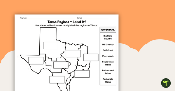
Supplement your Texas Social Studies curriculum with a region of Texas map labeling worksheet.
Identify and Label the Regions of Texas
Give your students the chance to explore the geography of the great state of Texas with a set of Map Labeling worksheets. These can be used as guided notes, homework, or study guides!
This fun and educational activity is perfect for geography students. Students will have fun matching the regions to their locations with an easy-to-use map activity.
What Are the Regions of Texas?
Texas regions referenced in this resource are
- Big Bend Country
- Hill Country
- Gulf Coast
- Pineywoods
- South Texas Plains
- Prairies and lakes
- Panhandle Plains
This product can be used as guided notes, homework, or a study guide!
Students must match the terms and descriptions of each region to its location on the map.
Two versions are available in the download. Version one requires students to use a word bank to fill in the blanks on the map. Version two is a cut-and-paste activity.
An answer key is included with your download to make grading fast and easy!
Easily Download & Print
Use the dropdown icon on the Download button to choose between the PDF or Google Slides version of this resource.
Because this resource includes an answer sheet, we recommend printing one copy of the entire file. Then, make photocopies of the blank worksheet for students to complete.
Turn this teaching resource into a sustainable activity by printing on cardstock and slipping it into a dry-erase sleeve. Students can record their answers with a whiteboard marker, then erase and reuse them.
Additionally, project the worksheet onto a screen and work through it as a class by having students record their answers in their notebooks.
This resource was created by Lindsey Phillips, a teacher in Michigan and Teach Starter Collaborator.
Don’t stop there! We’ve got more activities to shorten your lesson planning time:
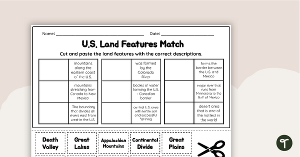 teaching resourceU.S. Land Features Matching WorksheetApply knowledge of the major U.S. rivers, mountains, and land features with a matching worksheet.  teaching resourceFree U.S. Mountains, Rivers, and Land Features WorksheetApply knowledge of the major U.S. land features, mountains, and rivers with a map labeling worksheet. 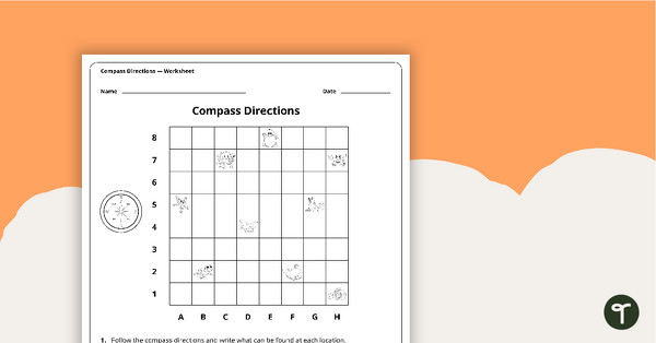 teaching resourceCompass Directions WorksheetA worksheet to use when exploring grids, grid references and direction. |


0 Comments
Write a review to help other teachers and parents like yourself. If you'd like to request a change to this resource, or report an error, select the corresponding tab above.