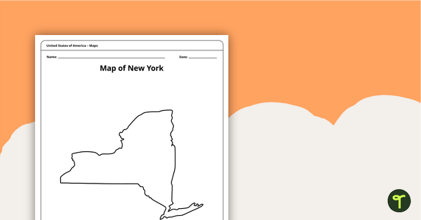
A blank printable map of New York State to use during Geography lessons.
Teach About the Empire State With a New York State Map
Whether you’re teaching New York State social studies or exploring the 13 original colonies, this printable map will come in handy for students learning NY geography!
Designed as a blank outline of the Empire State, the map can be used to test their knowledge of the important cities — including New York City, Buffalo, Rochester, and Albany — and landforms throughout the state.
Use the PDF version of the printable map to add your own details, or have students fill in the information to show what they’ve learned.
Encourage your students to add items to the Empire State map such as its capital (Albany) and other major cities in one of the original 13 colonies. Students can learn its state abbreviation (NY) and major rivers such as the Delaware and Hudson, as well as mountain ranges such as the Adirondacks and Catskills.


0 Comments
Write a review to help other teachers and parents like yourself. If you'd like to request a change to this resource, or report an error, select the corresponding tab above.