Maps Teaching Resources
- Plus Plan
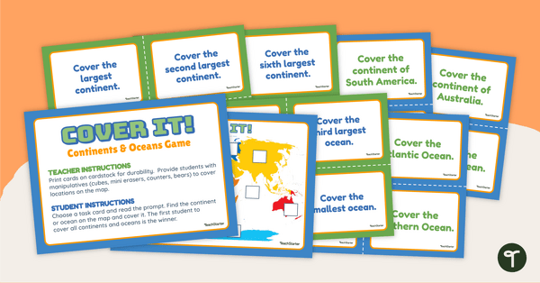
Continents and Oceans - Cover It! Game
Locate the continents and oceans of the world on a map with this engaging, hands-on Geography game.
- Plus Plan
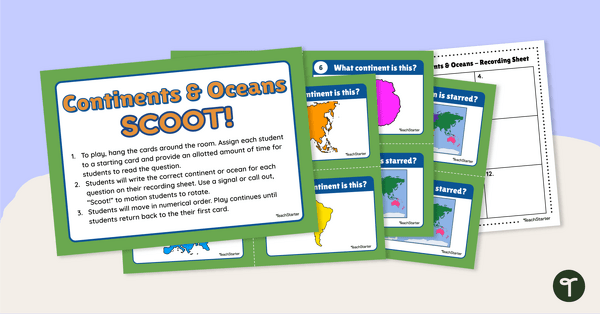
Continents and Oceans - SCOOT! Task Cards
Learn to locate and identify the continents and oceans on Earth with a game of SCOOT!
- Plus Plan
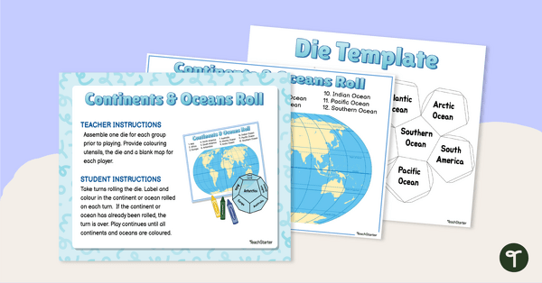
Continents and Oceans - Roll and Colour Game
Learn to identify the continents and oceans of the world with an engaging partner game.
- Plus Plan
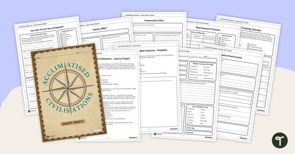
Acclimatised Civilisations – Inquiry Project
Research a civilisation and how it adapted to its environment and landscape through a student-led inquiry task.
- Plus Plan
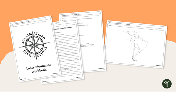
Acclimatised Civilisations: Andes Mountains – Workbook
Learn about the physical and human geography of the Andes mountains in South America with this inquiry-based mapping activity.
- Plus Plan
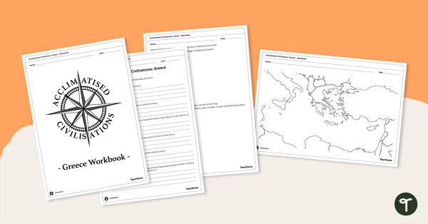
Acclimatised Civilisations: Greece – Workbook
Learn about the physical and human geography of Greece and the Mediterranean region with this inquiry-based mapping activity.
- Plus Plan
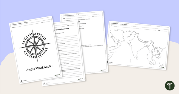
Acclimatised Civilisations: India – Workbook
Learn about the physical and human geography of the continent of India with this inquiry-based mapping activity.
- Plus Plan
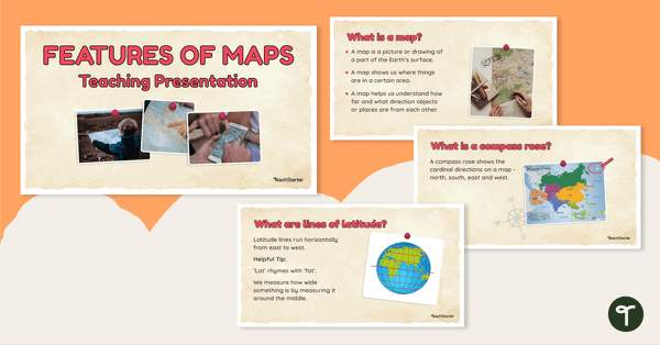
Features of Maps - Teaching Presentation
Explore the most common features of maps with this engaging teaching presentation.
- Plus Plan
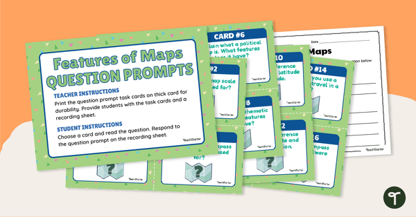
Features of Maps - Question Prompt Task Cards
Assess your students' understanding of the features of maps with this set of 16 question prompt task cards.
- Plus Plan
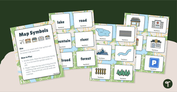
Map Symbols Match-Up Activity
Practise identifying the symbols found on a map with a map symbol matching activity.
- Plus Plan
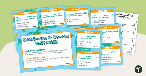
Continents and Oceans Task Cards
Practise identifying and describing the 7 continents and 5 oceans with a set of task cards.
- Plus Plan
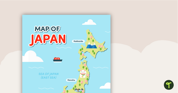
Map of Japan
A map of Japan featuring the names of the main islands and well-known landmarks.
- Plus Plan
Latitude and Longitude Banners
Latitude and longitude banners to display in the classroom when studying geography.
- Plus Plan
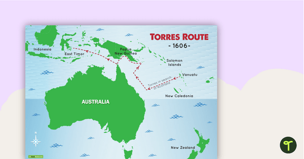
Torres Route 1606 Map
A map to display in the classroom when learning about Luis de Torres' route across the top of Australia in 1606.
- Plus Plan
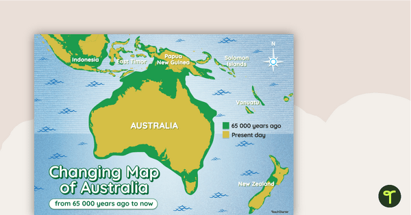
Changing Map of Australia - 65 000 Years Ago to Present Day
A map showing the changes in Australia's coastline from 65 000 years ago to the present day.
- Plus Plan
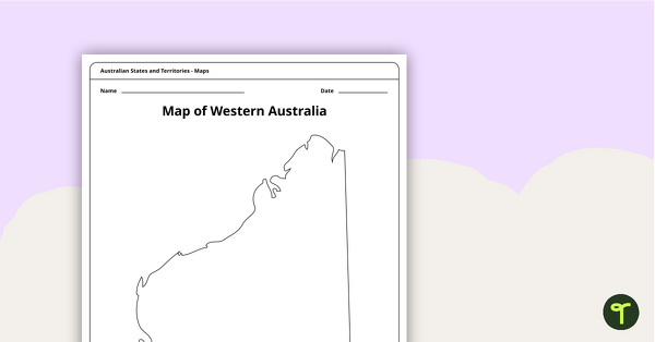
Blank Map of Western Australia - Template
Record and represent data about the location of significant places with this printable blank map of the Australian state of Western Australia.
- Plus Plan
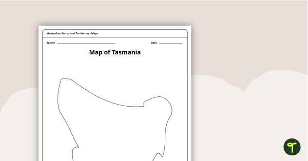
Blank Map of Tasmania Template
Record and represent data about the location of significant places with this printable blank map of the Australian state of Tasmania.
- Plus Plan
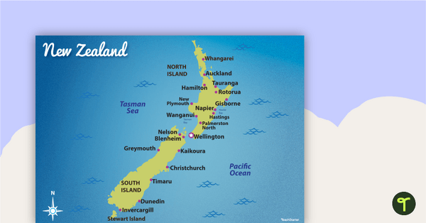
Map of New Zealand
Familiarise your students with Australia’s neighbouring countries with this detailed map of New Zealand.
- Plus Plan
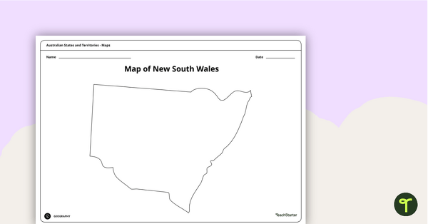
Blank Map of New South Wales - Template
Record and represent data about the location of significant places with this printable blank map of the Australian state of New South Wales.
- Plus Plan
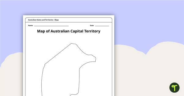
Black Map of the Australian Capital Territory - Template
Record and represent data about the location of significant places with this printable blank map of the Australian Capital Territory.
- Plus Plan
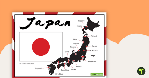
Japanese Flag and Map of Major Cities
A poster showing important information about Japan.
- Plus Plan
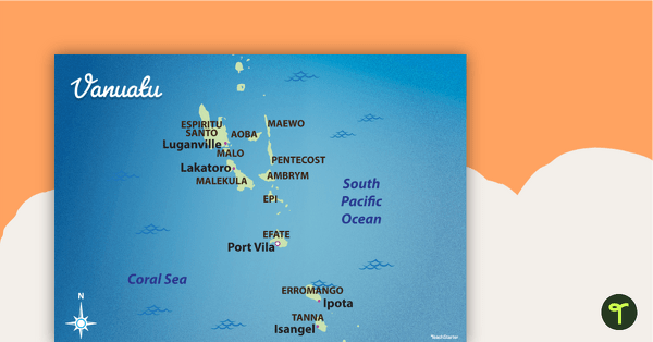
Map of Vanuatu
Familiarise your students with Australia’s neighbouring countries with this detailed map of Vanuatu.
- Plus Plan
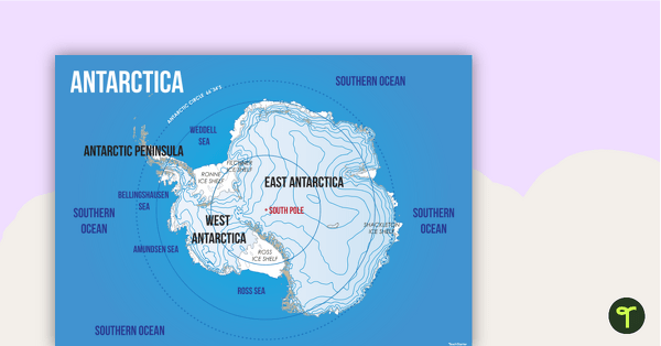
Map of Antarctica
Familiarise your students with the continent of Antarctica using a labelled map.
- Plus Plan
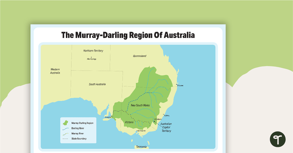
The Murray-Darling Region Of Australia Poster
A poster to show the Murray-Darling Region of Australia.
- Plus Plan
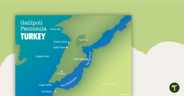
World War One Maps
A set of maps to use in the classroom when learning about WW1.
- Plus Plan
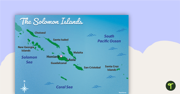
Map of The Solomon Islands
Familiarise your students with Australia’s neighbouring countries with this detailed map of The Solomon Islands.
- Plus Plan
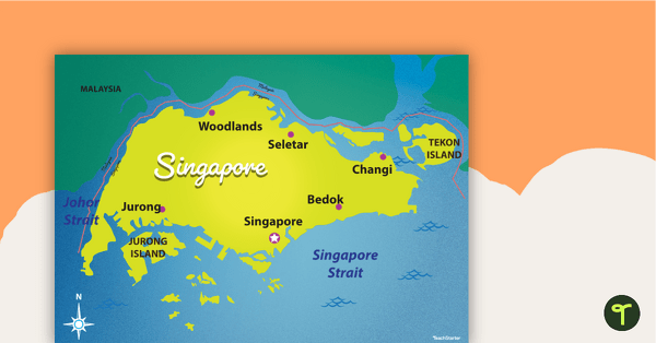
Map of Singapore
Familiarise your students with Australia’s neighbouring countries with this detailed map of Singapore.
- Plus Plan
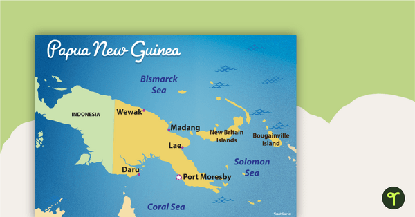
Map of Papua New Guinea
Familiarise your students with Australia’s neighbouring countries with this detailed map of Papua New Guinea.
- Plus Plan
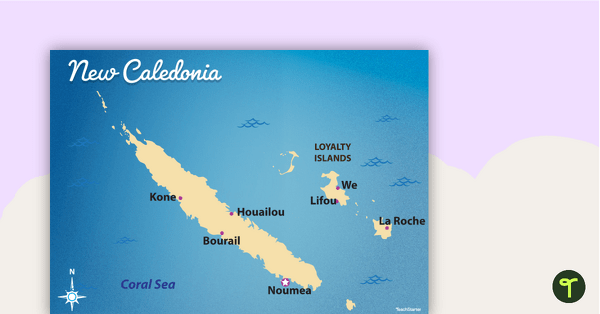
Map of New Caledonia
Familiarise your students with Australia’s neighbouring countries with this detailed map ofNew Calendonia.
- Plus Plan
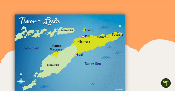
Map of Timor-Leste
Familiarise your students with Australia’s neighbouring countries with this detailed map of Timor-Leste.
- Plus Plan
Mapping Our World
A 60-minute lesson in which students revise locating and labelling the main features on the world map.
- Plus Plan
Australian States and Territories
A 60 minute lesson in which students will investigate how Australia can be represented on a map as states and territories.