Research and record facts and details about the different major mountains, rivers, lakes, and other landmarks in the U.S. with an interactive research guide.
U.S. Mountains, Rivers, and Lakes, Oh My!
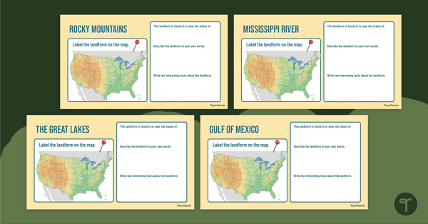
Labeling paper maps with significant landforms of the United States is so last year. We’ve put together the perfect digital resource to help your students research and record their learning about many of the major landforms in the United States of America.
With this Google Interactive activity, students are tasked to
- Locate major landforms on a United States map
- Identify states and surrounding landmarks for each landform
- Describe each significant landform in their own words
- Find and write down two fun facts about each landform.
What are the Major Land Features in the United States?
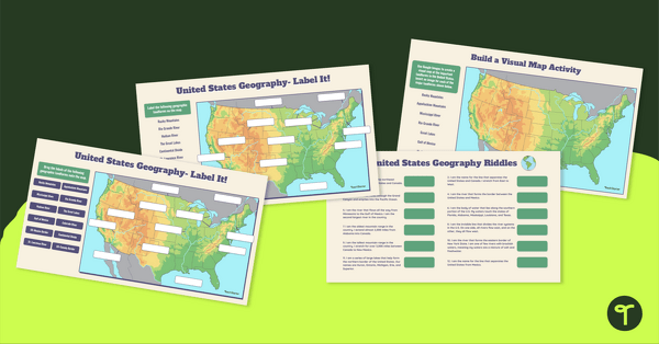
Through this activity, students will click, drag, and drop pins to locate landforms and research and write about each of the following major mountains, rivers, and land features in the United States.
- The Rocky Mountains,
- The Appalachian Mountains,
- The Rio Grande,
- The Mississippi River,
- The Hudson River,
- The Gulf of Mexico,
- The Great Lakes,
- The Continental Divide,
- The St. Lawrence River.
How to Prepare This Resource
Use the download button to download the Google Slides resource. Assign the activity to Google Classroom. Students will complete the activity in Edit Mode, not Presentation Mode.
Additionally, this activity can become a whole-group instructional tool by projecting it onto a screen and working through it as a class by having students record their answers in their notebooks.


0 Comments
Write a review to help other teachers and parents like yourself. If you'd like to request a change to this resource, or report an error, select the corresponding tab above.