Practice identification of the major rivers, mountains, and land features in the United States with a Google Interactive activity.
Studying Major Land Features of the United States?
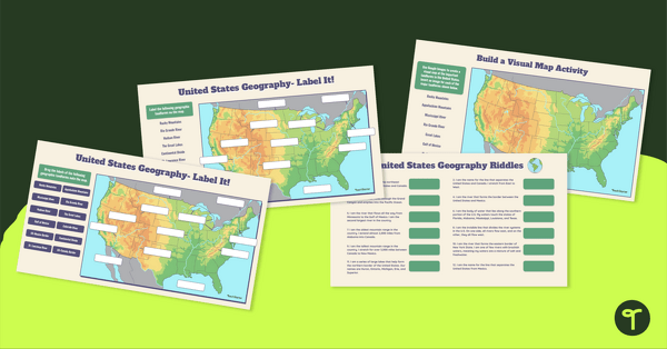
Physical geography is the study of the landforms and bodies of water of the Earth. The United States encompasses 3,537,441 square miles and has some spectacular land features. Help your students identify the features of our amazing country with an engaging Google Slides Interactive Activity.
With this Google Interactive activity, students are tasked to
- Drag and drop the labels of the following major geographic landforms onto a U.S. map.
- Type to label the major geographic landforms on the map.
- Use Google Images to create a visual map of the important landforms in the United States.
- Answer a series of 12 riddles about the different land features in the United States.
The major U.S. land features referenced in this activity are
- Rocky Mountains
- Rio Grande
- Hudson River
- The Great Lakes
- Continental Divide
- St. Lawrence River
- Appalachian Mountains
- Mississippi River
- Gulf of Mexico
- Colorado River
- US-Mexico Border
- US-Canada Border
How to Prepare This Resource
Use the download button to download the Google Slides resource. Assign the activity in Google Classroom. Students will complete the activity in Edit Mode, not Presentation Mode.
Additionally, this activity can become a whole-group instructional tool by projecting it onto a screen and working through it as a class by having students record their answers in their notebooks.
Don’t stop there! We’ve got more geography activities we know your students will love:
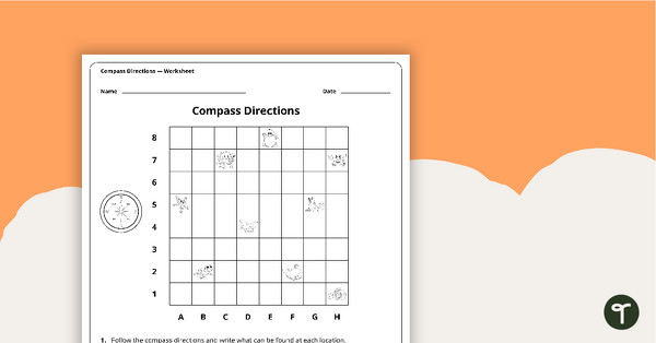
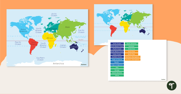
Explore the features of maps using this set of colorful classroom posters. A worksheet to use when exploring grids, grid references and direction. Discover and label the world's continents and oceans with this blank map of the world.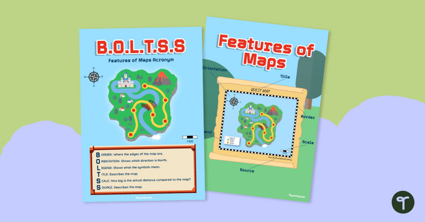
teaching resource
Features of Maps Posters - B.O.L.T.S.S
teaching resource
Compass Directions Worksheet
teaching resource
Map of the World - Labeling Activity


0 Comments
Write a review to help other teachers and parents like yourself. If you'd like to request a change to this resource, or report an error, select the corresponding tab above.