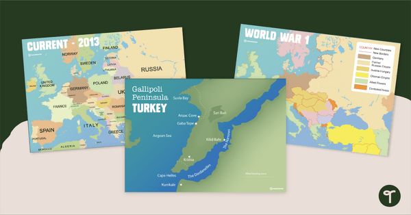
Printable map of Europe and World War 1 to use in the classroom when learning about WW1.
World War 1 – Maps of Europe for the Classroom
Use this collection of European maps with your students in the classroom when learning about WWI, Gallipoli, and the Anzacs.
This teaching resource includes:
- 1 map of the Gallipoli Peninsula
- 1 black and white map of the Gallipoli Peninsula
- 1 map of Europe during World War 1
- 1 current map of Europe.
Place these historical maps of World War 1 around the classroom for display purposes, or print them half-sized so that students can reference them as needed.


0 Comments
Write a review to help other teachers and parents like yourself. If you'd like to request a change to this resource, or report an error, select the corresponding tab above.