
Grab a blank map of North America created by teachers for your lesson plans. Available in Google Slides or as a printable PDF, it's packed with possibility!
A Printable Blank Map of North America for Labeling
Are you exploring the vast continent of North America with your students? You’re going to need a map!
Use this unlabeled, black-and-white map of North America to help your students become more familiar with the natural and human features of this diverse continent.
Using This Map of North America Worksheet
This blank map of North America makes a great addition to your Social Studies resources and can be used in a multitude of ways in your classroom. Here are some suggestions:
Label key locations as a whole-class activity
This versatile North American map can be projected onto your interactive whiteboard for a paperless lesson or class review session. Have students take turns coming to the board to locate and label key locations on the blank map using a whiteboard marker.
Create a progressive map of North America
At the beginning of a unit of work on North America, provide students with their own printed copy of the blank North America map. As students learn more about the landforms of the continent, they can add more and more detail to their maps, including the following significant features:
- Capitals of the United States, Canada, Mexico and other North American countries
- Major rivers of North America such as the Mississippi and the Rio Grande
- Lakes such as Canada’s Great Bear Lake and America’s Lake Superior
- Mountain ranges, including the Sierra Nevadas and the Canadian Rockies
What Are the Countries in North America?
The borders of each country in North America are outlined on this blank map to make it easy for students to identify the various countries. Need a quick reference? Here’s a list of the more than 20 countries of North America — including the island nations of the Caribbean – in alphabetical order:
- Antigua and Barbuda
- The Bahamas
- Barbados
- Belize
- Bermuda (British Overseas Territory)
- Canada
- Costa Rica
- Cuba
- Dominica
- Dominican Republic
- El Salvador
- Grenada
- Guatemala
- Haiti
- Honduras
- Jamaica
- Mexico
- Nicaragua
- Panama
- St. Kitts and Nevis
- St. Lucia
- St. Vincent and the Grenadines
- Trinidad and Tobago
- United States
Download Your Preferred File Format
Use the dropdown arrow next to the Download button to access the easy-print PDF version or the editable Google Slides version of this resource.
More Blank Continent Maps for Teachers
Keep exploring the world, one map at a time with more printable and digital maps created just for your classroom!

teaching resource
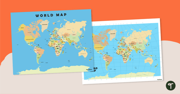
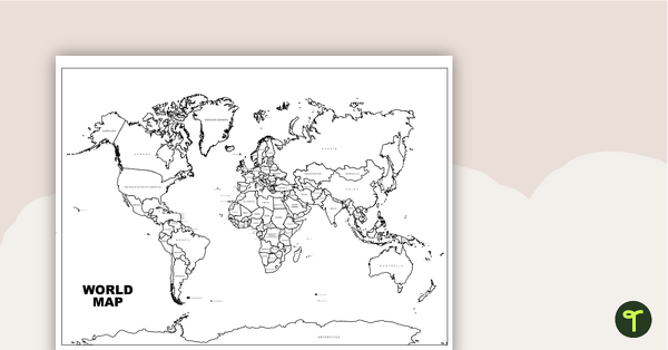
Blank Map of the World
Teach your students about the world’s seven continents and five oceans with this blank map of the world for labeling.
teaching resource
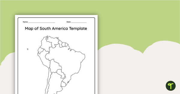
Blank Map of South America
This blank map of South America is perfect for elementary and middle school classes with editable Google Slides and printable PDF versions.

teaching resource
Blank Map of Europe Template (Printable & Digital)
Get a printable & digital blank map of Europe for your continent and oceans lessons!


0 Comments
Write a review to help other teachers and parents like yourself. If you'd like to request a change to this resource, or report an error, select the corresponding tab above.