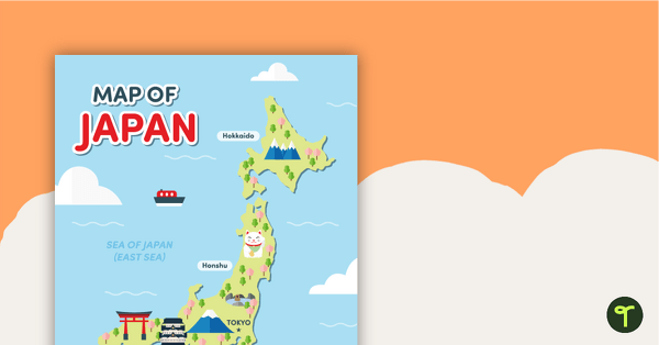
A map of Japan featuring the names of the main islands and well-known landmarks.
Display this poster in the classroom when learning about Japan.
It includes the main islands:
- Hokkaido
- Honshu
- Shikoku
- Kyushu
Updated: 21 Sep 2023
A map of Japan featuring the names of the main islands and well-known landmarks.
Non-Editable: PDF
Pages: 1 Page
Grades: K - 6
Use a calendar to describe and measure time in days, weeks, months, and years;
Identify ways in which people have modified the physical environment such as clearing land, building roads, using land for agriculture, and drilling for oil;
Explain how work provides income to purchase goods and services; and
Identify, locate, and describe the physical regions of Texas (Mountains and Basins, Great Plains, North Central Plains, Coastal Plains), including their characteristics such as landforms, climate, vegetation, and economic activities; and
Express ideas orally based on research and experiences; and
Describe political and economic regions in the United States that result from patterns of human activity;
Geography. The student understands the factors that influence the locations and characteristics of locations of various contemporary societies on maps and/or globes. The student is expected to:
Organize and interpret information from outlines, reports, databases, and visuals, including graphs, charts, timelines, and maps; and
A map of Japan featuring the names of the main islands and well-known landmarks.
Display this poster in the classroom when learning about Japan.
It includes the main islands:
Use a calendar to describe and measure time in days, weeks, months, and years;
Identify ways in which people have modified the physical environment such as clearing land, building roads, using land for agriculture, and drilling for oil;
Explain how work provides income to purchase goods and services; and
Identify, locate, and describe the physical regions of Texas (Mountains and Basins, Great Plains, North Central Plains, Coastal Plains), including their characteristics such as landforms, climate, vegetation, and economic activities; and
Express ideas orally based on research and experiences; and
Describe political and economic regions in the United States that result from patterns of human activity;
Geography. The student understands the factors that influence the locations and characteristics of locations of various contemporary societies on maps and/or globes. The student is expected to:
Organize and interpret information from outlines, reports, databases, and visuals, including graphs, charts, timelines, and maps; and

We create premium quality, downloadable teaching resources for primary/elementary school teachers that make classrooms buzz!
Would you like something changed or customised on this resource? While our team makes every effort to complete change suggestions, we can't guarantee that every change will be completed.
Did you spot an error on this resource? Please let us know and we will fix it shortly.
Are you having trouble downloading or viewing this resource? Please try the following steps:
If you are still having difficulty, please visit the Teach Starter Help Desk or contact us .
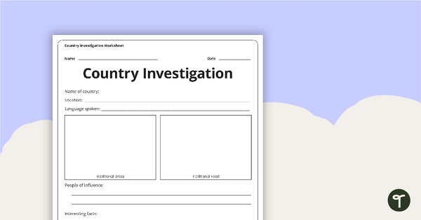
A recording worksheet for students to use in the classroom when researching different countries and cultures.
Twenty-seven black and white worksheets with a selection of flags from Europe.
Seventeen black and white worksheets with flags from North America.
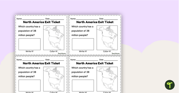
Assess student knowledge of the features and countries in North America with quick and easy exit tickets.
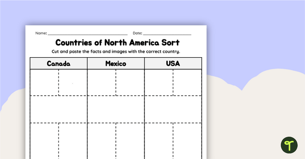
Practice identifying North American countries' locations, flags, and symbols with a quick and easy sorting worksheet.
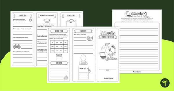
Research and write a report on the school system from a different country with this brochure template.
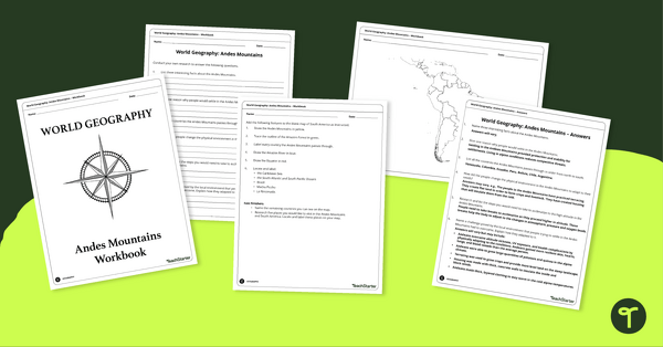
Explore civilizations in the Andes Mountains with students using the printable map and worksheet pack for sixth graders.
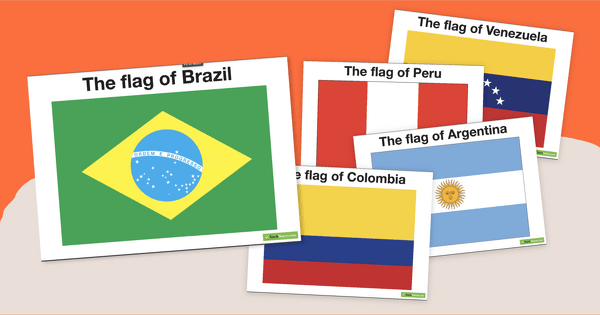
Decorate your travel-themed classroom with a set of fourteen colored flags from South America.
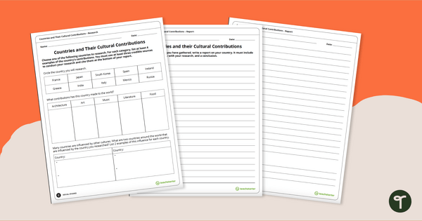
Research the cultural contributions from countries around the world with this research activity.
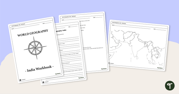
A workbook for students to use their investigation and map skills while learning about civilizations in India.
0 Comments
Write a review to help other teachers and parents like yourself. If you'd like to request a change to this resource, or report an error, select the corresponding tab above.